One of my main regrets about visiting a place like Zion for only a few days and with limited equipment is not being able to get back into the more remote areas of the park. It's the broader problem with road touring while on a limited schedule... stuck to the roads. While I'm blown away by what I've seen here, it's been a jet-set of highlights within a dayhike of the roads. I'd love to invent a bike pannier that doubled as an overnight hiking backpack so I could drop the crowds of people who are often more interested in the tamed squirrels than the unreal geology surrounding them. But alas, with a schedule to keep and a few days of riding to get back to my start/finish point, it is sadly time to raise the anchor and set sail (literally, in a sense, as today will be my first with tailwind so far!)
I caught up with Ken & Rilla again for a final farewell, and lingered over an hour as new friends parted our ways. I took Ken up on his generous offer to lend me another spare tire (since I'd used my only one back on Day 2.) Better safe than sorry in these parts.
The road from the eastern entrance to the bottom of the canyon is being rebuilt, and I discovered after riding in that way that bikes are, in fact, prohibited in the construction zone. Which is alright I suppose, because while the descent was spectacular, the climb back out of the canyon could have taken almost half the day. So I thumbed it, and I waited... and waited, and waited a full hour as countless vehicles cruised by, either unable to fit my bike or unknowing/unwilling to lend a hand.
Eventually a nice fellow named Clarence stopped to ask my destination... of course I jumped at the opportunity. I only needed to hitch the 12mi to the east Zion park entrance, where the construction zone ended, but he decided to head all the way out to HW89 and then south. So, although I was bummed to miss some fun descents that I'd struggled up previously, after losing several hours to delays already it was wise to take the warp speed option. At HW89, I headed north with the winds, and Clarence headed south on his meandering journey. I tried to give him a few bucks for gas... he paused and said, "no, just wish me luck."
Couldn't resist a pit stop at the ice cream parlor in the tiny town of Orderville...
Lots of open road, lots of sunshine. Making great time with the tailwind today. The red plateau in the distance where all the lines converge is the west side of the Bryce Canyon formation.
I got back to HW12 and headed uphill towards Bryce. Passing through Red Canyon campground about an hour before sunset, I chose to save the $15 site fee and instead just refilled my water and pushed onward up the canyon until dusk. I ended up sleeping on some BLM cow pasture a little off the main road, just a few miles before the Bryce turn-off. No glory here, just another cold night back up at 7800ft.
Wednesday, September 15, 2010
Tuesday, September 14, 2010
Utah Day 6: hiking in Zion
Another great night of warm sleep and hot breakfast before setting out in the park again today. My main agenda was to hike to the top of the famous Angel's Landing trail. I first checked out a few other easily accessible sights along the canyon shuttle, such as the Weeping Wall and the original visitor's center (now used as an artist-in-residence residence.) Angel's Landing is basically a 2.5mi, 1500ft climb to the very point of a massive vertical rock formation that juts out from the canyon floor.
It's a bit hard to sense the scale from this photo, but the trail ends at the highest point of the shear rock face:
After about 2mi, including the Walter's Wiggles section of 21 tight switchbacks, and Scouts Lookout, you find the last half mile up this tight ridge. There are crude steps carved into the rock at some spots, as well as heavy chains to grapple up. And signs warning of death from slipping. It's a bit unnerving
At the top, it's 1200ft straight down. Literally. You can see the river, road and two shuttle buses way down below. Up this high (at almost 5800ft) the winds were really kicking and swirling, with 30mph gusts making the already precarious ledge that much shakier.
The views were endless! This is looking south (downstream) at Zion Canyon and the Virgin River.
After soaking up the vastness of the surroundings and marveling at the nervy chipmunks who had absolutely no fear (or realistic awareness??) of the heights as they bounded and scampered, it was time to head back down. I think it was a little scarier climbing up, and a little more impressive heading down.
It's a bit hard to sense the scale from this photo, but the trail ends at the highest point of the shear rock face:
After about 2mi, including the Walter's Wiggles section of 21 tight switchbacks, and Scouts Lookout, you find the last half mile up this tight ridge. There are crude steps carved into the rock at some spots, as well as heavy chains to grapple up. And signs warning of death from slipping. It's a bit unnerving
At the top, it's 1200ft straight down. Literally. You can see the river, road and two shuttle buses way down below. Up this high (at almost 5800ft) the winds were really kicking and swirling, with 30mph gusts making the already precarious ledge that much shakier.
The views were endless! This is looking south (downstream) at Zion Canyon and the Virgin River.
After soaking up the vastness of the surroundings and marveling at the nervy chipmunks who had absolutely no fear (or realistic awareness??) of the heights as they bounded and scampered, it was time to head back down. I think it was a little scarier climbing up, and a little more impressive heading down.
Monday, September 13, 2010
Utah Day 5: hiking in Zion
It was about 30'F warmer last night than in Bryce, what a comfortable sleep. Windy but warm. I'm settling into a couple days of exploring Zion primarily on foot. They have Disney-esque free shuttles servicing the canyon road (no cars allowed, hence no auto traffic) all of which equipped with bike racks up front. I chose to shuttle up to the end of the line, and ride back out at the end of the day. These are my rest days, after all.
Zion Canyon was cut by the Virgin River, leaving striking vertical walls of Navajo Sandstone towering above the softer Kayenta Formation closer to the valley floor. It's an unreal spectacle. The paved road follows the river upstream ~14mi, til the canyon gets too narrow. Then there's a paved footpath for another mile, and eventually you are free to set out right into the river and hike through the water into "The Narrows" which gets down to 10ft wide at places. This, of course, I had to check out. The cool water was awfully refreshing on my tired legs & knees! Some sections had room to hike along the sandy/rocky banks, while others were just wall-to-wall agua beneath 1000ft vertical cliffs, wading thigh-deep in the river.
An interesting feature is water seeping from the canyon walls and cracks, creating a curious stereophonic array of drips, bloops, trickles & echoes as well as feeding lush ferns and mosses. There are many "hanging gardens" high up on the walls, the last place you'd expect to find lush rainforest vegetation. Rainwater soaks in to the porous rocks on the flat tops of the rock formations and over the course of literally hundreds of years, makes its way downward until it finds a way out. They've determined some of the water fell as rain over 1200 years ago and is just now percolating out of the rocks.
I hiked upstream several miles before turning around and emerging back into the afternoon openness:
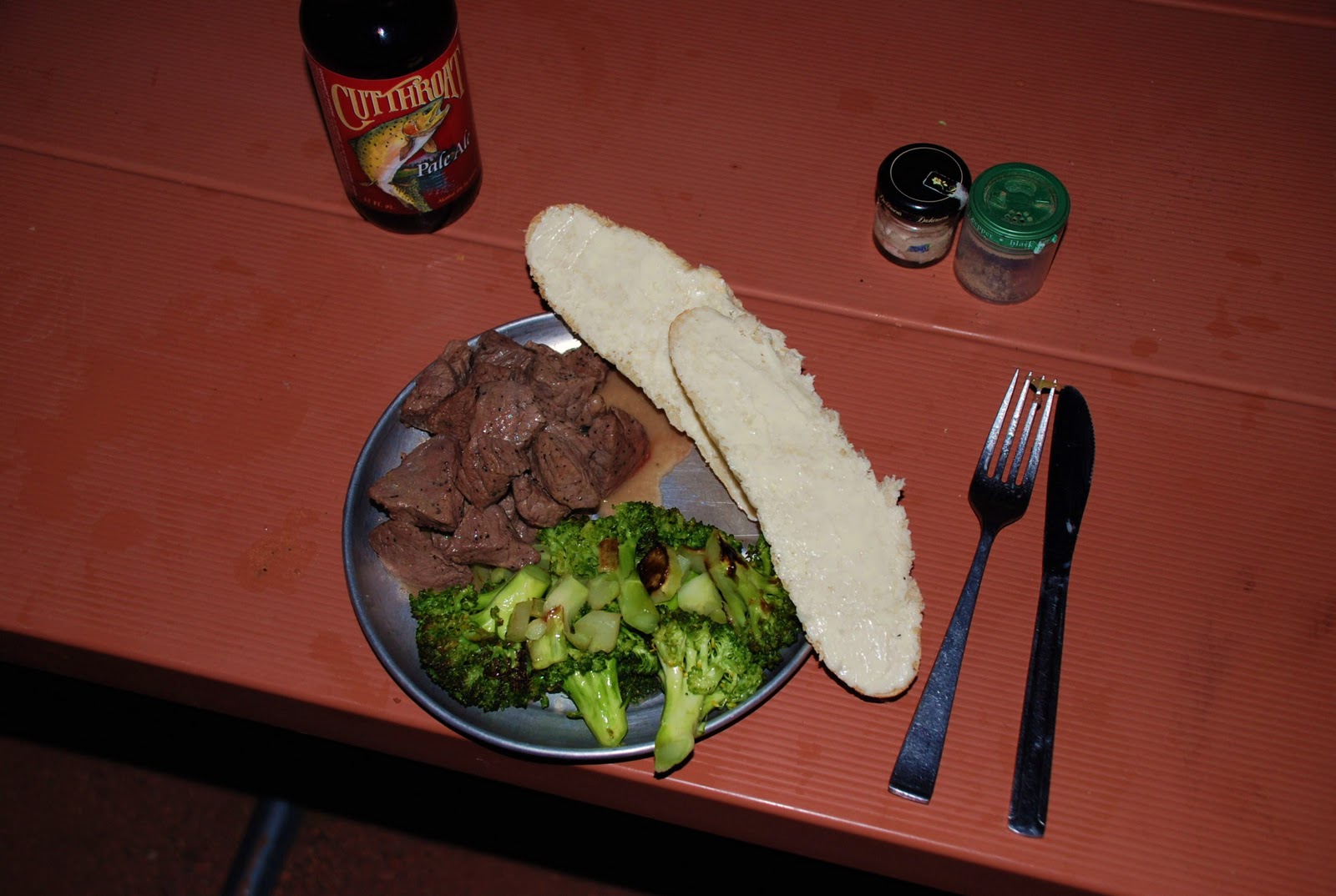
One of the most luxurious aspects of camping at Zion is that the town of Springdale abuts the west park entrance. Although it's your standard fare tourist outcropping, having immediate access to a grocery store is a godsend for any cycle tourist. Instead of packing food for its weight-vs-energy/protein ratio, browsing a market for (questionably) fresh produce & meat was pure decadence. Pair a couple local beers with dinner and I may as well be dining at the French Laundry.
Zion Canyon was cut by the Virgin River, leaving striking vertical walls of Navajo Sandstone towering above the softer Kayenta Formation closer to the valley floor. It's an unreal spectacle. The paved road follows the river upstream ~14mi, til the canyon gets too narrow. Then there's a paved footpath for another mile, and eventually you are free to set out right into the river and hike through the water into "The Narrows" which gets down to 10ft wide at places. This, of course, I had to check out. The cool water was awfully refreshing on my tired legs & knees! Some sections had room to hike along the sandy/rocky banks, while others were just wall-to-wall agua beneath 1000ft vertical cliffs, wading thigh-deep in the river.
An interesting feature is water seeping from the canyon walls and cracks, creating a curious stereophonic array of drips, bloops, trickles & echoes as well as feeding lush ferns and mosses. There are many "hanging gardens" high up on the walls, the last place you'd expect to find lush rainforest vegetation. Rainwater soaks in to the porous rocks on the flat tops of the rock formations and over the course of literally hundreds of years, makes its way downward until it finds a way out. They've determined some of the water fell as rain over 1200 years ago and is just now percolating out of the rocks.
I hiked upstream several miles before turning around and emerging back into the afternoon openness:
One of the most luxurious aspects of camping at Zion is that the town of Springdale abuts the west park entrance. Although it's your standard fare tourist outcropping, having immediate access to a grocery store is a godsend for any cycle tourist. Instead of packing food for its weight-vs-energy/protein ratio, browsing a market for (questionably) fresh produce & meat was pure decadence. Pair a couple local beers with dinner and I may as well be dining at the French Laundry.
Sunday, September 12, 2010
Utah Day 4: Bryce Canyon to Zion Natl Park - 87mi
Just about as cold last night, right around freezing... luckily it's time to drop a few thousand feet of elevation to the warmer desert climate in Zion. Said my goodbyes to Ken & Rilla, although I hope to run into them again at Zion where they'll arrive a day after me. Meeting them and making a great friendship in only a few days around the campsites has really been a highlight of my trip thus far. These guys are those all-too-rare folks you feel like you've known for years after just a few hours.
I had to hit the road early hoping to make the long journey to Zion in one day. Headwinds again, like every riding day so far. Although Zion is a whopping 4000ft lower than Bryce, several grinding climbs separate the two Natl Parks. Between the distance and strong wind it was a grueling day indeed, but the long gentle descents were appreciated!
Red Canyon, just west of Bryce, has a fantastic bike path along almost the entire stretch of road out to HW89:
What satisfaction to finally make it Zion and roll past features like this towards campgrounds in the valley:
Hitched a ride in the bed of a pickup through Zion Tunnel (too narrow for bikes amongst cars) and popped out to this view on the west side of the tunnel. The road to the bottom of the canyon is a series of hairpin switchbacks that drops about 1300ft in only a couple miles, and you feel like these massive walls are growing up around you as you float down between them.
I scored a "walk-in" site at the (otherwise full) campgrounds, and it is the perfect setup for bike touring. Nestled away from cars but close to water & bathrooms, it even has a large bear-box to store food & gear.
I had to hit the road early hoping to make the long journey to Zion in one day. Headwinds again, like every riding day so far. Although Zion is a whopping 4000ft lower than Bryce, several grinding climbs separate the two Natl Parks. Between the distance and strong wind it was a grueling day indeed, but the long gentle descents were appreciated!
Red Canyon, just west of Bryce, has a fantastic bike path along almost the entire stretch of road out to HW89:
What satisfaction to finally make it Zion and roll past features like this towards campgrounds in the valley:
| Checkerboard Mesa |
| my first glimpse into Zion Canyon |
| my cozy home for the next 3 nights, Watchman Campground |
Saturday, September 11, 2010
Utah Day 3: exploring Bryce Canyon
Took today to explore Bryce and will share Ken & Rilla's campsite again tonight. Very cold night here- overheard an RV dweller say her thermometer read 32'F at sunrise. My thrift store sweater helped although not quite enough... but a hot breakfast & coffee sure was a treat:
Hiked the Queens/Navajo Loop trails in the main amphitheater in the morning, winding beneath and amongst the novel Hoodoo formations:
In the nick of time, I hopped the free afternoon tourbus up to the southern terminus of the Bryce Road at Rainbow Point and saved myself a 17mi, 1900 vertical ft climb. I was by far less than half the average age of my fellow bus passengers, and the only one with a bike in the cargo bay.
The views were spectacular and the ride back down to camp was terrific fun:
Hiked the Queens/Navajo Loop trails in the main amphitheater in the morning, winding beneath and amongst the novel Hoodoo formations:
In the nick of time, I hopped the free afternoon tourbus up to the southern terminus of the Bryce Road at Rainbow Point and saved myself a 17mi, 1900 vertical ft climb. I was by far less than half the average age of my fellow bus passengers, and the only one with a bike in the cargo bay.
The views were spectacular and the ride back down to camp was terrific fun:
Friday, September 10, 2010
Utah Day 2: Calf Creek to Bryce Canyon - 69mi
Made a few bike adjustments last night before a cold sleep. My compact 30'F sleeping bag and bivvy sack combo weren't really sufficient for the higher elevations and cooler temps than I'd encountered this time last year in the southeastern Utah desert. Ken & Rilla invited me to share their next campsite at Bryce, and so long as I made the distance I'd have a nice place to sleep... an offer I can't refuse, but a big day ahead with several big climbs.
I left camp an hour before Ken, but he caught me topping out the first climb. We started from the flats below in the background (Escalante River valley.)
Dropped down into the valley to find it flooded with these gorgeous yellow flowers. Table Cliff Plateau in the background:
5mi before the town of Escalante (5800ft), my first mechanical. Threads on the front tire failed (due to the pannier weight I suppose. Touring on old Kenda 25c road slicks? Maybe not the best idea.) Surprised to find NO tires in town, so installed my one spare at a small outfitter who loaned me his floor pump. While in town, I also picked up a $3 cashmere(!) sweater from the thrift store for the cold nights. And a delicious Americano coffee. Minor delays, then onward into more relentless headwinds.
Summiting over Table Cliffs before a nice, well deserved descent back down to Henrieville at 6000ft
After the buying some groceries in the tiny town of Tropic, a big final 2000ft climb up the Paunsaugunt Plateau to the 7900ft entrance of Bryce, just as the sun was sinking low. I was exhausted and elated and darn happy with my efforts. Found Ken & Rilla and set up camp just before the the sun set.
I left camp an hour before Ken, but he caught me topping out the first climb. We started from the flats below in the background (Escalante River valley.)
| must be nice climbing sans ~60 lbs of gear! |
Dropped down into the valley to find it flooded with these gorgeous yellow flowers. Table Cliff Plateau in the background:
5mi before the town of Escalante (5800ft), my first mechanical. Threads on the front tire failed (due to the pannier weight I suppose. Touring on old Kenda 25c road slicks? Maybe not the best idea.) Surprised to find NO tires in town, so installed my one spare at a small outfitter who loaned me his floor pump. While in town, I also picked up a $3 cashmere(!) sweater from the thrift store for the cold nights. And a delicious Americano coffee. Minor delays, then onward into more relentless headwinds.
Summiting over Table Cliffs before a nice, well deserved descent back down to Henrieville at 6000ft
After the buying some groceries in the tiny town of Tropic, a big final 2000ft climb up the Paunsaugunt Plateau to the 7900ft entrance of Bryce, just as the sun was sinking low. I was exhausted and elated and darn happy with my efforts. Found Ken & Rilla and set up camp just before the the sun set.
Put in almost 6000 vertical ft of climbing today. Into wind. Second day. Achilles tendons hurt. I'm tired.
Thursday, September 9, 2010
Utah Day 1: Bicknell to Calf Creek - 58mi
Got a bit of a delayed departure from Denver by way of goofing off and taking care of some last minute stuff. But I still should have plenty of time for my loose itinerary of biking solo, unsupported, from Torrey, UT (just west of Capitol Reef Natl Park) south to Bryce Canyon, then to Zion, and back around to my rendezvous point. Should be roughly 450mi, and take 8-10 days. I'm carrying all my gear, which weighs in at around 60lbs including the panniers.
Drove out last night, met a nice couple who invited me to park my car on their property in Bicknell (just west of Torrey/Capitol Reef) and shoved off this morning into 30mph headwinds for a 3300ft climb up and over the 9,600ft summit of Boulder Mountain. 10-12% grades at points of that grueling climb. What a way to bust out of the gates.
After the summit, the winds were so strong on the southern face that I still had to pedal hard while going downhill. Seems like I can't win today, but it's great to be chugging along on two wheels. The road drops 3000ft down to the town of Boulder before jamming right back up the hogback ridge separating it from the Escalante River valley. Once up top, it's a marvelous view into the Escalante Staircase and a sweet, steep ridgeline descent down to the valley floor.
I met this great Wisconsin couple a few different times along on the road today. Ken rides his Lemond road bike between campgrounds and Rilla drives ahead with all their camping gear- this year's journey takes them all the way from Fruita, CO to the Grand Canyon! Ken passed me up the Boulder Mt climb, then again up to the Escalante ridge (he'd stopped for lunch in town, lucky guy.) I found them again at the top of the ridge, where they gave me a freshly picked pear and graciously invited me to share their campsite that night. These here are some really wonderful folks.
Drove out last night, met a nice couple who invited me to park my car on their property in Bicknell (just west of Torrey/Capitol Reef) and shoved off this morning into 30mph headwinds for a 3300ft climb up and over the 9,600ft summit of Boulder Mountain. 10-12% grades at points of that grueling climb. What a way to bust out of the gates.
| leaving my car behind for the next 9 days |
| "Pedal Faster" road tag taunting me up a 10% grade |
| Boulder Mountain summit - 9600ft |
| descending into Escalante River valley |
I met this great Wisconsin couple a few different times along on the road today. Ken rides his Lemond road bike between campgrounds and Rilla drives ahead with all their camping gear- this year's journey takes them all the way from Fruita, CO to the Grand Canyon! Ken passed me up the Boulder Mt climb, then again up to the Escalante ridge (he'd stopped for lunch in town, lucky guy.) I found them again at the top of the ridge, where they gave me a freshly picked pear and graciously invited me to share their campsite that night. These here are some really wonderful folks.
| Calf Creek Campground w/ Ken & Rilla |
Monday, September 6, 2010
Utah bike tour preparations
Getting my trusty Bianchi cross bike set up for this year's Utah tour. Going with full panniers this time after using a B.o.b. trailer on last year's tour. Planning to start near Capitol Reef Natl Park, head through Escalante Staircase, Bryce Canyon, Zion, and back around. 8-10 solo days on the road, can't wait!
Learned a lot during last year's Utah tour so I'm setting up the bike with easier gearing, as well as ditching the clunky trailer. Now I've got a 32-12T cassette, and swapped on my mountain bike triple cranks (44-32-22T) so I can lumber up the steep inclines at a snail's pace, but still make it up. Also a handlebar bag this time around. For panniers I went with the Ortlieb roll-tops in the rear for their full waterproofness, and some larger Axiom's in the front for their many zipper pockets & compartments.
And enjoying some fantastic meals from the garden before I hit the road!
Learned a lot during last year's Utah tour so I'm setting up the bike with easier gearing, as well as ditching the clunky trailer. Now I've got a 32-12T cassette, and swapped on my mountain bike triple cranks (44-32-22T) so I can lumber up the steep inclines at a snail's pace, but still make it up. Also a handlebar bag this time around. For panniers I went with the Ortlieb roll-tops in the rear for their full waterproofness, and some larger Axiom's in the front for their many zipper pockets & compartments.
| prepping the tour bike |
And enjoying some fantastic meals from the garden before I hit the road!
Saturday, September 4, 2010
September -- garden harvest taking off
Sunday, August 22, 2010
Road trip!
The weekend started with free tickets to the Beatles tribute band at Red Rocks on Saturday night before camping under the stars at Kenosha Pass.
| good morning along the Colorado Trail |
Next stop, Florissant Fossil Beds Natl Monument:
| petrified trees |
We stumbled into a Veterans' Biker Rally in Cripple Creek
And capped it off with a visit to the vintage arcade in Manitou Springs
Sunday, August 15, 2010
August 14-15, 2010 -- backpacking to Woodland Lake
Wednesday, August 4, 2010
Lance sighting in Denver
I happened to catch Lance at the Capitol announcing 'his' Quizno's Pro Challenge stage race, slated for Colorado in summer 2011. Love him or not, I'm super stoked to see some real deal pro road teams racing in our mountains.
And then the masses lined up to 'ride' with Lance... but I had to go back to work. Easily a thousand bikers found time for a Wednesday morning group ride, by way of twitter.
| I swear that's him at the podium |
And then the masses lined up to 'ride' with Lance... but I had to go back to work. Easily a thousand bikers found time for a Wednesday morning group ride, by way of twitter.
Subscribe to:
Posts (Atom)