Saturday, June 9, 2012

Reykjavik

Spent today milling about the hipster/cultural hub of Reykjavik. Of the ~330,000 people who inhabit Iceland, almost 2/3rds of them live the in the greater Reykjavik metro area. Legendary for its late night locals party scene and such creatives as Bjork and Sigur Ros, I was very curious to see what it was all about. Turns out it's actually pretty cool, albeit the tourist hub as well. Kind of a mix of San Francisco, Austin, and some old-world charm with narrow cobbled streets mingling with mod architecture and sprawling 'burbs. It has the highest concentration of coffeeshops that I've ever witnessed, and I lived in Boulder for 4 years! [And not a single Starbucks]
"Knit-bombing" Reykjavik style
best hotdog ever- topped with beer mustard, tartar aoili and crunchy fried onion bits
hipster bar having a street party, complete w/ accordion player
at the apparently defunct bicycle collective
someone left me a surprise gift... it was tasty!

Friday, June 8, 2012

Keflavik > Reykjavic, the long way [72mi, 2800ft gained]

After a slow morning organizing and re-packing my panniers, fixing my broken speedometer bracket (with leftover clear packing tape that I'd neglected to throw away at DIA) and trying in vain to track down my favorite pair of sunglasses which I'd accidentally left in the bathroom, I hit the road for Reykjavik. Instead of taking the direct route on the busy highway (this being Iceland, that's a relative term) I opted to head down along the southern shore of the peninsula and cut up north through the inlands.
leaving Keflavik behind until July 3rd

It was a bit surprising to see vast patches of brightly flowering purple Columbine flowers roadside... our Colorado State Flower! They would be a common sight along the coastal route today. I tend to assume they're an imported/invasive species, but they sure are pretty.

After a fairly short time I crossed the "Continental Trench" where the North American and European continents meet. This trench grows by about 2cm per year due to plate tectonics and it's a thermal/volcanic zone. Nearby is a geothermal power plant that acquires water from wells drilled 2-3km deep, where the water is almost 300'C.
"Bridge Across Continents" [Europe left, North America right]

Along the coast is mostly jagged volcanic rock, which has a strange mossy covering that seems to have died... or maybe it's always white? Either way it looks like a covering of snow.

After a coffee stop alongside Grundlavik Harbor, I trended inland into a decent head/crosswind and finally got to Rd 42 as the afternoon was getting late. No worries, though, as daylight is not a concern in these parts. The crosswind was now at my back and progress was quick until I reached my first "Malbec Endar" (Pavement Ends) of the ride, which required navigating washboard bumps and steep kickers around this large beautiful lake [you'll have to forgive the lack of proper names of towns and features, I have no clue unless I find it on a map- which is not at hand currently.]

The day took much longer than I'd hoped, but I finally rolled into the Reykjavik Campground at 10pm. It's essentially a big city park for tents (for ~$10/night) with geothermal water showers and a communal kitchen supplied with hotplates, cookware, dishes and boxes of freebie food left behind by other campers.

A unique experience is that it currently does not ever get dark here. The sun eventually sets but it stays light and feels like a perpetual dawn, chirping birds and all. This is not helping my jetlag! I took this photo at 2:30AM (no flash needed) then proceeded to read (no headlamp needed either) until I fell asleep at 3AM:
Reykjavik City Campground circa 2:30AM
Tomorrow it's off to check out the city and stay a 2nd night at the campground.

an aside: Tour Divide beginneth

Before anything else about me, I want to give a shout-out and big "go get 'em!" to my old friend & mountain bike buddy, former co-worker, and super-duper insane ultra distance competitive cyclist Eszther Horanyi, who begins the Tour Divide today. This is a 2800mi, solo, 100% self-supported mountain bike race all the way from Canada to Mexico via the Continental Divide National Scenic Trail. There's something in the neighborhood of 265,000 vertical feet of climbing, grizzly bears, snow, rain and heat. Racers are allowed no outside support aside from services they find along the way. This is longer than the Tour De France, almost all off road, and the winners generally finish in fewer days than the Tour.

Eszter's out to destroy the women's record this year, here's wishing her a safe and fruitful trek!

Follow her progress on via Spot Tracker here.
*************************************************************

Thursday, June 7, 2012

Finally... off to Iceland!!!

 After a very hectic few weeks of preparing to leave the country for three months (purging a majority of non-essential belongings, sorting & storing the stuff I'm keeping, moving out of my apartment and packing for a 3mo bike tour) I'm finally here in Iceland. Scrambling down to the last minute before my departure, the trek overseas has been a smooth one. 


Not exactly what you expect to see when boarding an airliner:
"Welcome to Iceland Air, where we tell you you're going to hell!"
The flight was smooth... I was so exhausted from the past few weeks that I fell asleep before we even took off. When I woke up later I thought we were still on the ground, but discovered we were at full cruising altitude. Iceland Air gets an A+ in my book for this flight: the ticket agent didn't charge me the standard $40 surcharge for my bike box, and they delivered it and my 2 panniers in good condition! Not to mention 100+ free movies to choose from and the flight attendants wear cute 1960's era hats :)


I landed in at the Keflavik International Airport (about 55km from Reykjavik) at 6:30am local time and got my bike & luggage in short order. Next was a phone call to the Alex Campground, who showed up to drive me and my bike to their facilities about 5min away. A major perk of this campground is their offer to store (for free!) my empty bike box during my tour. I'll pick it up when I stay with them on my final night here.
Alex Campground airport shuttle service
I spent the morning assembling my bike (luckily it arrived unhurt except for a broken speedometer mounting bracket- damn you, TSA) and reorganizing my gear. I've been pedaling around the old shipping/fishing town of Keflavik this afternoon, procuring a few supplies and admiring the scenery. Tomorrow I'm off to Reykjavik for a couple days before heading north to begin my circumnavigation of the island. On July 5 I fly to Paris, so the clock's a tickin!


Everyone here has been great- the Icelandic folks seem fairly reserved but very friendly and they transition instantly into fluent English. Most signs also have either English or a picture, so language hasn't been an issue. Yet. The weather's cool, cloudy and breezy with an occasional drops of rain... but its pleasant and about what I expected. Mountains in the distance, rolling plains to the east... feels a lot like Colorado minus the blazing sun.

Tuesday, May 22, 2012

4 day Mini Tour: Denver > Longs > Ned > Boulder > Denver

My last big push physically before my 3 month summer tour begins- and more importantly I think, a trial run with the 'new' bike and my gear setup. Set up the bike last weekend, packed up on Wed/Thurs and I took a 'vacation' day Friday and hit the road at 7am headed west.


My agenda for the long weekend: bike tour to Longs Peak, hike to the summit of Longs, ride to Nederland and then find my 'puter seat in the courier office on Monday morning.

I elected to climb via Golden Gate Canyon, the most direct route onto the Peak To Peak HW. It is a long, long climb... a few years ago when I was "training" for my first Utah Tour, I tried to climb this road, sans gear. I had to surrender to bowing my head over my bars near the top of the long ascent. Yet today I, smugly, crushed it. 50lbs of gear and I made a steady snail's pace up into the upper edge of the Foothills. Not to brag, but all my training has really paid off! I used to think that working as a courier counted as training. False. Very false. Since early January, you could say I've been sorta focused on training, 5-6 days/wk... running, swimming, weights, yoga, some spin classes, a few weights/spin/yoga (what the hell is that?) and of course many long rides in the mountains made possible by the unseasonably warm and dry winter we had.

So after 16mi of rolling flats and 18mi of of climbs, I finally gained the Peak To Peak HW

From here I headed north on the P2P for ~50mi, undulating between 8K and 9.4Kft  through Nederland, Ward, Allenspark. Shortly prior to the Longs trailhead/camp turnoff, I stopped by Olive Ridge campground and met Roland & Margaret, a retired Swiss couple halfway through their year long RV tour from Buenos Aires to Alaska to NYC! They shared a beer (american Budweiser) as we chatted about my euro tour and art museums near Basel, their hometown.
 
Despite threatening rain clouds all afternoon, I arrived dry at the Longs Peak campground, still closed for the winter, around dusk. Some overnight storms brought rain, lightening and sleet and I packed up camp still encased in ice at 5:30am Saturday morning. 82mi and 9900ft gained my first day out with full gear.

Hit the 7.5mi (each way) Longs trail at 7am on foot and climbed above a beautiful inversion

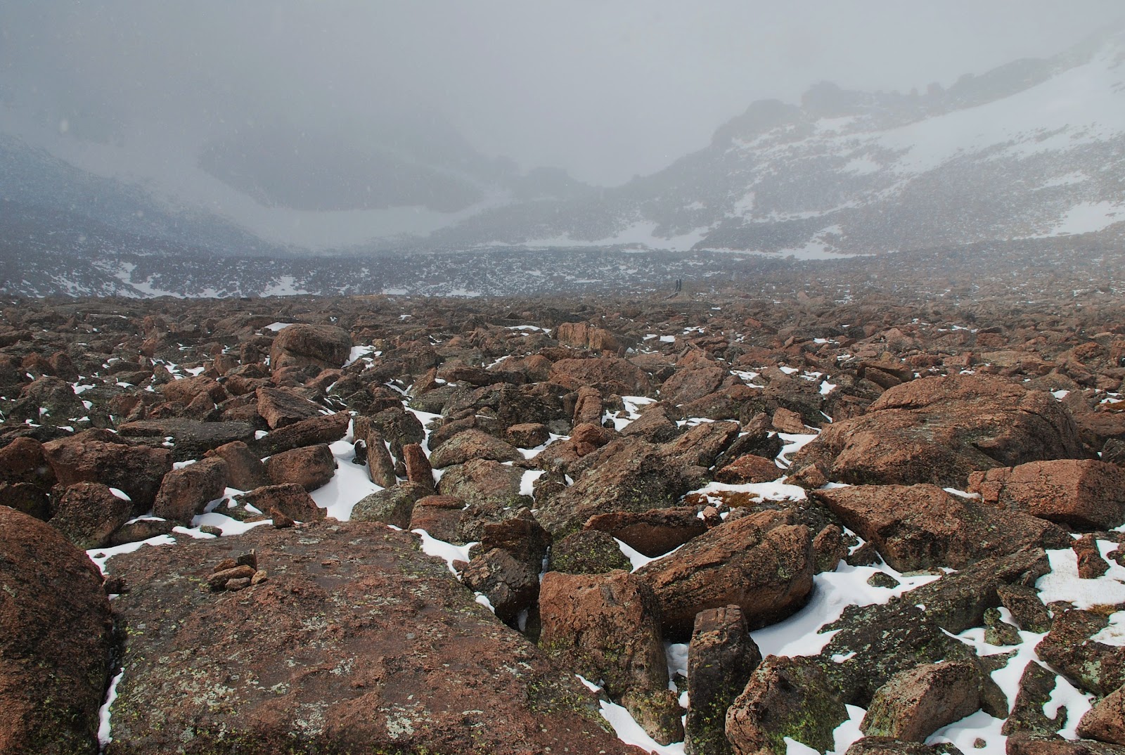
The weather was spotty; snow flurries w/o accumulation all day. A few times I considered turning back but each time I'd stop to regroup, the clouds would start to break before I was ready to turn tail. And so I kept pushing up and ahead. Until I got through the boulder field and saw a tent, I'd been the only person hiking up this high today.
the "trail" through the boulder field en route to The Keyhole
I pushed through 'The Keyhole' and things started to get far more intense in terms of climbing, altitude and weather. The signs had warned that this was "not a hike" rather a "climb" and I finally began to understand their advice. The backside of The Keyhole was no joke; one wrong slip would send you sliding down into dire consequences!
The Keyhole
The red/yellow bullseye paint marks the "easiest" route to scramble beyond The Keyhole.

Traversed the west ridge and caught up to two Tennessean brothers while ascending "The Trough." Now that I wasn't alone up here in the dicey conditions, all three of us pushed onward through "The Notch" and across "The Narrows." The snow was picking up and starting to accumulate, and the warmer rock faces were beginning to freeze over. Things were getting messy and dangerous. We made it to the very last steep pitch before the Summit Ridge when one of the brothers looked ahead and murmured, "This is stupid."

We all agreed. One slip, which was increasingly likely, would lead to instant death as you cascaded off the cliffs below. We turned back at 13,900ft, just 350ft below the summit. Wise decision... wiser yet would have had us heading down much sooner. There were no epic views, no grand ski lines, no majestic summit. We were just experiencing it for what it was, but that was perhaps better than running into a trail traffic jam on a bluebird day with people streaming onto the summit.
13,906ft
  The return back to the Keyhole was harder than the climb up because the continuing snow/wind was covering our tracks as well as the painted route markers. And shit was getting slick! We progressed very slowly and cautiously with only a few scares; when the Keyhole came into view all 3 of us let out a howl of relief. The risk had not abated entirely, but the worst was behind us. I made haste down the mountain towards my bike/gear so I could ride back down to the Natl Forest campground 6mi south. The sky was still dropping flakes when I returned to the trailhead at 9400ft, but the storm was breaking up and I let out for the other campground where I knew I'd have the next day for the 'dryer cycle' aka Colorado sunshine!

As I dried, organized and hashed out my gear, I had the realization that this stuff, give or take a few items, will be my only worldly possessions for the next three months halfway around the world. I think I'm comfortable with this prospect... certainly wish I didn't have an apartment full of crap to deal with.

In the afternoon I hit the road again and headed south on the P2P HW for 35mi to camp in the National Forest near where I often go mountain biking. Weather squalls missed me again; 2 out of 3 ain't bad. In the early morning I packed up and rolled into Nederland for a morning coffee before jamming down the canyon to work dispatch duties in the courier office.

After 9 hours in the office, it was back to the road to ride home to Denver through the 'burbs. A very successful 4 day trek! About 175mi on the bike and almost 15mi of high alpine hiking for the long weekend.

Sunday, May 6, 2012

Denver > Squaw Pass > Bear Creek > Deer Creek; 102mi, 8000ft gained

I began my weekend with hopes up riding the paved road to the summit of Mt Evans at 14,264ft. However, a cold storm front was approaching and the forecast called for a 70% chance if thunderstorms in the afternoon. So I tried anyway despite not expecting to be able to safely (or comfortably) gaining the summit. Alas, I made it up to Squaw Pass at 9807ft while the clouds were swirling in and the temps were dropping. I could see my breath, and knew that it'd be in the upper 20's once up another 4500ft higher.


So I bailed on my Evans summit goal and instead rode to the end of the line up Squaw Mountain. It was 45 degrees here at 10,600ft. Not quite the amazing vista I'd hoped for, but I do appreciate having cell reception:

Some good views on the way back down to Squall Pass, however:

I cut over down Witter Gulch gravel road to Upper Bear Creek Canyon Rd, which eventually led into the town of Evergreen. From there I continued down to the little village of Kittridge and turned south on Meyers/Parmalee Gulch Rd to get to Deer Creek Canyon. I'd ridden these canyons a few months ago; it was fun to hit them backwards today.

I love this section of Deer Creek; you might think you were in the southern Utah desert:

Took a couple of detours on the bikepath ride home in order to surmount 100 miles... if you're gonna ride well over 90mi, may as well bag a Century, right? I'm disappointed not to have summitted a 14er today, but glad not to have gotten caught in a frozen thunderstorm above treeline. Hopefully the weather improves by next weekend and I'll go for it again.

Saturday, May 5, 2012

my new friend

As my 3 month summer tour approaches, I lucked into a sweet deal on a Surly Long Haul Trucker touring bike via my coworker's girlfriend's brother. Today I finally got over to pick it up and bring it home. It's a 'beaut, my new friend the 'Iceland Machine.' This bike is designed and built especially for touring and I'm stoked to have the right tool for the job this summer. On my previous Utah tours I successfully utilized my old aluminum Bianchi cyclocross frame, but for a journey of this magnitude I wanted something more durable and purpose driven. Now I've got it, for a good price and pristine peace of mind. Thanks, Declan! [photos coming soon]

sunset mountain biking Nederland; 1700ft gained

I was covering dispatching duties in the Boulder office again today; brought the mountain bike along and hopped on the bus up to Nederland after work. I squeezed in about 2.5hrs of trails in the convenient West Magnolia / High School trail system. Actually found some new trails I'd not explored before, which was fun.


The high country aspens are just beginning to send out their buds:

And eventually I found some leftover snow around 8700ft:

Rolled back through the town of Ned around 8pm with plenty of daylight left. Bombed down Boulder Canyon under the full "Super Moon" and treated myself to a post ride dinner of burger n beers at the Mountain Sun brew pub. What a way to spend a Friday night, yes?!?

Sunday, April 29, 2012

mountain biking Golden

The warm winter brought many sweet road rides this year... but I finally fixed up the mountain bike and headed out with my old friend Brian. We lugged along for 18mi into a strong headwind along the Clear Creek Bike Path to reach the bottom of Chimney Gulch trail and began the long climb up to the top of Lookout Mountain. I've climbed the paved road plenty of times and seen this trail along the way; it was rewarding to finally do this climb on the dirt.


After a long slog we topped out Lookout, had a lunch and prepared to bomb right back down our ascent. This trail is surprisingly tight and fun for being so close to town! We ripped it and then soft-pedaled with the wind at our backs to his place in Wheatridge. Post-ride beers and catching up ensued. It was a fantastic Saturday and felt great to be back on the fat tires for the first time since October.

Friday, April 27, 2012

Boulder Indoor Velodrome night, part II

Thanks to my buddy and former coworker Brian, and the good graces of former Motorola Team rider Keith Harper, the dirty Denver messengers got another go around on the velodrome. Thanks, guys! We tore it up for a few hours on Friday night... fun times indeed


Sunday, April 22, 2012

Denver > Lookout > Dinosaur Ridge > Bear Creek; 63mi, 3200ft gained

I had larger aspirations for today's ride, but wasn't feeling so hot and bagged my original route. Instead, I knocked off Lookout Mountain outside Golden, then headed south along Dinosaur Ridge and up and over. I eventually ended up near enough Bandimere Speedway dragstrip and listened to some muscle cars rip down the 1/4mi strip but couldn't see much. Despite not getting in my multiple major climbs like I'd intended, it was a good day on the road bike. I feel like I pansy for only pedaling 63mi w/ insignificant climbing, but some days are made for taking it easier.

classic switchbakcs on Lookout Mountain Road

Wednesday, April 18, 2012

Boulder > 4 Mile Canyon > Gold Hill > Sunshine Canyon: 23mi, 3100ft gained

I had to work in the Boulder office dispatching our bike couriers today so I took the opportunity to get in a quick road bike ride in the mountains after I got out from behind the computer. Started up Boulder Canyon for a few miles, then northwest up 4 Mile Canyon (another classic Boulder area climb.) This area had been devastated by the infamous 4 Mile Fire back in September 2010- burning over 130 homes and making it the most destructive (to man-made structures, anyway) forest fire in Colorado's history. I hadn't been here since the fire occurred and have been wanting to see the aftermath first hand. It's a fun, steep climb located conveniently close to town, gaining about 3000ft in 13mi from Boulder.

The road turns to packed dirt after about 6mi and gets into the thick of the burn area.

Continuing upwards, I reached the historic mining town of Gold Hill at 8100ft. The firefighters luckily saved this little mountain community and its 100+ year old structures from the fire. Just barely, as you'll notice how close the burn came to town. 

Topping out around 8300ft above Gold Hill, it was downhill back into Boulder via Sunshine Canyon. I was glad when the bumpy dirt road turned back into pavement so I could open it up safely for the long twisty descent into town.
backside of the Flatirons on the upper left

2 hours; 23 miles and 3100ft of climbing. Another day at the office.

Sunday, April 15, 2012

"powder" day at Loveland Ski Area

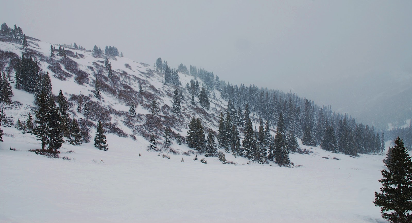
The weather forecast called for 50 degrees and rainy in Denver today, worse in the mountains. Not exactly a promising outlook for an epic bike ride. I still had one lift ticket to Loveland to use this season so I drove up for a day on the slopes. Despite our crazy warm winter/spring this season, today could've passed for January- 30 degrees and snowing, with about 6" of new snow last night. The fresh fall covered up the ice and a lot of the rocks; conditions were the best I've skied all season.

When I was here two weeks ago, it could've been June. Today was a whole different world.


top of Lift #9 at 12,700ft

Saturday, April 14, 2012

Mitchell Communtiy Garden, opening day 2012

It's April and it's time to start gardening! With our unusually warm spring this year, it's been feasible to get seeds and plants started extra early this season. As "garden leaders," April and I brought out all our new and returning gardeners for a work day to get things in gear for growing tasty food in the community garden. I can't wait to start eating delicious fresh salads from the soil we cultivate!

Soon, oh so soon, we'll be flush with healthy, tasty greenery...


Friday, April 13, 2012

Friday evening half-marathon run

The weather forecast killed my challenge to see how many consecutive century ride weekends I could string together, so I decided to do a long run on Friday instead. I started out aiming for 10mi (I normally do a ~6mi tempo run) but once I got going, figured "what the heck, let's just do a half marathon." And so I pressed on.

I've never been much of a runner, never participated in the Track & Field or Cross Country teams in high school and generally regarded running as slow, boring and hard. Until last year, when I decided I ought to incorporate running into my workout routine as a form of cross training. I also wanted to do some impact exercise, as cyclists are at risk of developing bone density problems later in life because our bones have it so easy on smooth spinning bikes all the time. So I started running once a week and found that I actually enjoy the time a lot- it's a great cardio workout, a nice time to devote to listening to music and my thoughts and the chill redundancy provides a very relaxing yet taxing platform to settle into. I'm still no star runner, but have improved a lot and value my weekly runs on the South Platte River bike path.

I wouldn't have guessed I could've ever run over 13mi in one session, but kept going until I'd done it. I was tired by the end, my calves and feet hurt and my legs were exhausted. I felt great! Not a bad way to spend a few hours after work on a Friday night, yes?

Wednesday, April 11, 2012

Wednesday evening hike on Indian Creek Trail

My friend Lucy wanted to go for a hike (she's car-less, I provided the transport and she provided the motivation.) T-storms rolled into Denver that afternoon, it hailed briefly, we went anyway. We attempted to get to a trail west of Sedalia (southwest of Denver) she knew that leads to an old fire watchtower... however the access road was closed for forest maintenance. So we continued up HW67 for a minute and found the Indian Creek Trailhead. I'd ridden this same road a couple weeks ago, just before a week before the Lower North Fork forest fire broke out in the area I'd ridden through. Today was a pleasant post-rain hike for a couple of miles through a recently thinned forest... and came to a neat vista in the late evening light.

We'd hit a perfect storm-less window, as Denver was treated to another round of boomers after I got back home. Fantastic to get out of the city and into the woods after a Wednesday workday.

Scrub Oak patch looking south from Indian Creek Trail summit in Jefferson County

Sunday, April 8, 2012

Boulder > Lyons > Peak To Peak > Golden > Lookout > Denver: 114mi, 9950ft gained

Hopped on the 8am bus up to Boulder, grabbed a coffee and a couple delicious Santiago's breakfast burritos, then rolled alongside the foothills on HW 36 to Lyons. From town, I headed west up the South St. Vrain River canyon, aka HW 7.
Highway 7 west of Lyons

Eventually I met up with the Peak To Peak Highway after the tiny village of Raymond. This is the fourth time I've ridden the Peak To Peak this year, each time accessing it via a different climb from the Front Range. After today, I've ridden the entire 68mi of high elevation road, save for the very first few miles at the southern end of the highway. (One of these days I'm going to include this entire route in a single day ride... but there are still many more remote roads to explore first.)
looking north from the Peak To Peak Highway near Rollinsville
I turned onto sometimes dirt Gap Road to link into Golden Gate Canyon near the state park. I came across this foreboding signage- luckily (as I expected) this 19% grade was downhill in my direction of travel. Although aiming down a 19% grade on a road bike still feels pretty wild. Perhaps one day I'll come back to ride up it... it'd be a fun challenge to tackle that fairly short section. At this point I had 70mi on my legs for the day and didn't have time to session it today.
Gap Road north of Golden Gate Canyon
After descending to Golden Gate Canyon State Park, I diverted back north on Crawford Gulch Road to try see something new, since I've ridden the canyon several times. Crawford was a beautiful, quiet road that meandered around and connected to Golden Gate much closed to Golden.

Passing through Golden, it was a little after 6pm and I still had some daylight and energy left, so I knocked off Lookout Mountain since I was in the neighborhood. I passed "the pillars" at mile 89 for the day, and got up to the top as the sun was sinking low.
Lookout Mt
I turned around at Buffalo Bill's grave and blasted down the switchbacks I'd just ridden up. This road is usually dense with auto and bike traffic, but on a late Easter Sunday evening it was safe to open it up and really carve the descent. 32min up the climb, 9min back down.

Back through Golden and towards Denver as darkness set in (I bring my lights on all these long rides for just such reasons.) I stopped off at a grocery store to get some goodies for a solo Easter dinner: some cheap ham slices, asparagus and a big potato for baking. It was a delicious meal after 114mi and 9950ft of climbing for the day! I'm bummed to fall just shy of the elusive 10K climb day, but will get it soon. And then some.

Sunday, April 1, 2012

skiing at Loveland Resort

Yet another beautiful bluebird day here in Colorado so I woke up early, threw my ski gear in the car and drove up to Loveland. I still have a couple of lift tickets to use up before the snow melts, and that might be sooner than later this lousy snow season. I was still pretty fatigued from yesterday's big ride and spent more time basking in the sun than ripping up the slopes.

Views up at the top of Lift #9 (12,700ft) were great, but the lack of snow is startling.
looking southeast- I70 below and twin 14er peaks of Torrey's (L) and Gray's (R) standing tall and barren
Snow looks a little better off to the northwest, but still nothing like we're used to for April Fools Day

Despite the low snow, the skiing was still fun and the goofball energy that comes with spring skiing is fantastically amusing. Unbeknownst to me, it happened to be 80's Retro Day and lots of fun loving riders broke out their best thrift store skiwear. There was an 80's cover band and a fashion contest. And lots of good cheer in the air.
"Best Dressed" fashion contestants vying for a brand new snowboard