Showing posts with label Front Range. Show all posts

Monday, October 1, 2012

Double 14er Mini Tour [Pikes Peak & Mt Evans: 9/25-10/1; 430mi, +41,000ft]

On a cold, soggy late August morning in Dresden, I opened my email to find a note from my bike-adventure-maniac friend Justin Simoni. It went something like, "Hey your trip looks like it's going great. Got any climbing legs left? Because...."   And he went on to inform me that during this September only, the folks who operate the Pikes Peak Highway tollroad are allowing bicycles on their road for the first time ever. Want to come ride up Pikes (14,110ft) and Mt Evans (14,264ft) with him? Sure!!

I have to admit I was pretty nervous about agreeing to ride with Justin for several days. He routinely takes adventure touring to a new level, he's insanely fast and mighty determined. He's got lightweight touring down pat. He won top singlespeed honors Great Divide Mountain Bike Race this year. As for me? Sure, I'd been touring for 3 months, but it wasn't fast or light, and it certainly wasn't at high altitudes. Until riding around in Ned last week, the highest I'd been since May was around 9,000ft on the Cime de la Bonnette in France. But what the hey, I'll give it a go. We planned an interesting route- Denver south to Waterton Canyon, then about a dozen miles of singletrack on the Colorado Trail, 50mi of dirt roads to Woodland Park, up Pikes Peak, north to pick up the CO Trail again to Bailey, over Guanella Pass, up Mt Evans and then back to Denver.

The weather was looking a bit dicey for the next few days, but not imposing enough to cancel the trip. So we set off to Tuesday evening and camped in the drizzle a little ways up the CO Trail. The next morning was alternatively fun and challenging negotiating 10mi of switchback singletrack on the CO Trail. Cyclocross-singletrack touring is an interesting endeavor to say the least. 
Justin, one half of the two CX touring weirdos
the Colorado Trail

The trail was a fun way to start the trip, but I could immediately tell there was no way I was going to keep up with Justin. This became even more evident along the 40mi of endless rolling hills and soft dirt that was Rampart Range Rd. We spent the day somehow sneaking in between some massive thunderstorms along the way, me feeling increasingly frustrated at my inability to keep Justin in my sights. He was totally mellow about it, never got impatient or agitated- but it's no fun for either rider when there's such a discrepancy of speed.

The next morning we paid our $10 admission fee (they charge the same for a bike as for a car, but at least we're allowed in) and began riding up the 19mi climb from the entrance gate in Cascade to the top of "America's Mountain". The colors were still gorgeous!
Pikes Peak, our destination
Justin was waiting for me at the Halfway Point picnic grounds (mileage wise, anyway) and I told him to go on ahead without me. I was going to get myself up to the summit, but I didn't want him to spend half a day waiting for me. And I knew I didn't have it in me to ride over Guanella Pass (11,669ft) the next day, and Mt. Evans the day after that. We shook hands, wished each other luck, and he quickly disappeared around the next bend. I was on my own now- I really enjoyed riding with Justin, but it felt good to turn him loose and now poke along at my own snail's pace.

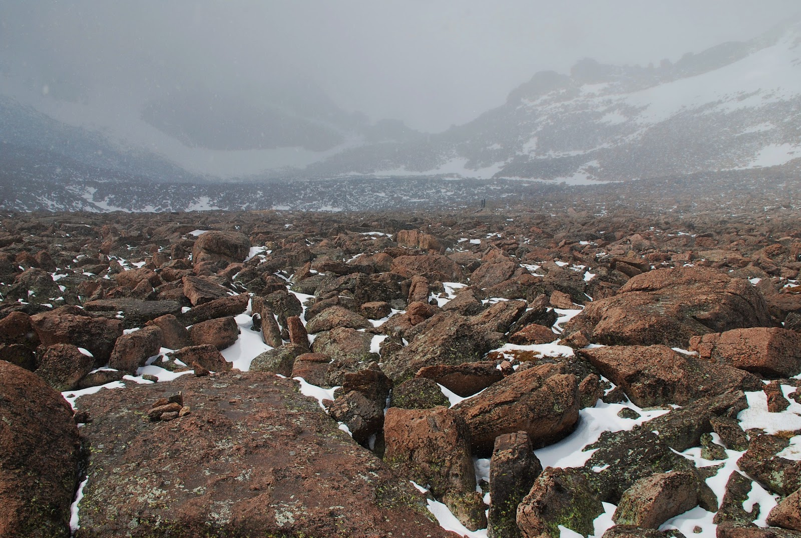
I got to the Glen Cove cafe/gift shop at 11,450ft and stopped in to use the bathroom, eat a snack and have a coffee. Some clouds were rolling over the ridge to the west and a few snow flakes were blowing around. As I readied to continue up the road, the ranger informed me that the road above was now closed until this storm passed. And he advised me that I really ought to head back down before it got worse. "Just sayin', this is 27 years of experience here talkin'." Fair enough, but I went inside and refilled my coffee to wait and see what the skies would do. I only had 6mi to go before the top; it would be a shame to ride down from here. The snow/sleet continued to build, the same ranger then said there's a 2nd, larger storm about 40min out, and that I really, really should get off the mountain now. I decided he was right- I couldn't go up because the road was closed, and I was potentially going to descend in accumulating snow or ice. I retreated; the weather had got me.
Round 1 goes to Mother Nature
Three times now I've attempted to summit a 14er using only my own power and transport... ie no driving to the trailhead. I tried Mt Evans this spring on my road bike but turned back at 10,500ft. In May I toured to Longs Peak, hiked into a blizzard and made it up to just 300ft below the summit before I couldn't safely get any further. And now I'd been foiled on Pikes as well. As I descended the sleet thawed into rain; I stopped into a diner in Cascade for lunch and to see what the storms were going to do. They got worse, just as the ranger predicted. It poured rain, it poured hail, and it still looked threatening. Justin had been fast enough to get ahead of the road closure- I knew he was somewhere up high in this mess, but then again this is sort of his forte and I knew he'd survive just fine.

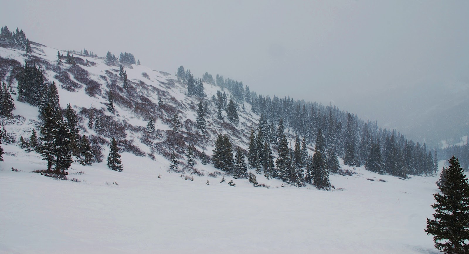
And I threw in the towel. I was wet, cold, tired, and mentally demolished. I waited for a break in the precip and coasted down towards Colorado Springs where I could hop on the regional FREX bus back to Denver. All I wanted was a hot shower, a blanket and a bowl of steamy soup. It hurt to quit: I've never been a fast rider, but I've never been a quitter. However I'd had it- I was cracked.

On the way down I did take a sidetrack to ride around Garden of the Gods, which I'd been wanting to see. It's a cool city park, kind of CO Springs' version of Denver's Red Rocks Park.
Garden of the Gods
When I stopped into the Visitor Center in the Springs, I was told the FREX bus has stopped running. Like, for good. Dammit! Now I was down in the Front Range city sprawl, still wet and cold, and looking at riding ~85mi back to Denver on flat, boring, busy roads. I started making my way north through the endless suburbia that is CO Springs and well after nightfall, discovered a great 'campsite' beneath a bridge of a 4 lane divided highway.
morning #3: under the bridge
I woke up well rested, dry and warm. As I emerged from beneath the bridge to continue the slog back to Denver, I turned around and stared at Pikes Peak looming large in the sky. Without a cloud around, it was a perfect day. Pikes was shimmering with the fresh snow it picked up yesterday afternoon, it was calling me back. No way I'm going to quit! I turned around and backtracked through the Springs and back up the canyon, intent on getting to the top of this mountain after all. I can do this, and I'm gonna do this.

By the time I'd resupplied food, eaten breakfast and backtracked (mostly) uphill for 30mi, it was getting a little too late to try to ride to the top today. So I enjoyed a chill afternoon in the little artsy mountain town of Manitou Springs and waited for darkness to come in order to begin in earnest early tomorrow. And what a sight the next morning from camp:
morning #4: a clear shot at my mark
I made it up to the summit around 1pm with bluebird skies and a fantastic sense of accomplishment. My first 14er-- and all under my own power. Fourth time's a charm, apparently.
Pikes Peak summit!!
The vibe was reminiscent of the big Cols in the French Alps- lots of cyclists around and a strong sense of camaraderie amongst us. It was cool to see so many bikes up top, as well as those still grinding up or already zipping down. The summit it a bit of a circus: there's the auto road, there's a popular hiking trail and there's the Manitou Pikes Peak Cog Railway that brings groups of tourists to the summit, including heffers in flip-flops and old ladies asking (sincerely) for supplemental oxygen. There's a gift shop and a restaurant, it's essentially ski-resort-meets-tourist-trap.
No, I did not spend the $20 for this shirt...
The ride down was pretty fun, and pretty cold. The road (like most in Colorado) is just not steep/winding enough to be serious fun like I had in the Alps... but you can't have it all every time. I gathered up my panniers which I'd stashed in the woods closer to the bottom and took some gravel backroads to get back to Woodland Park for another tasty burger and more groceries. Next stop: Mt Evans! The weather outlook was solid and I'd become very determined to accomplish my original goal of riding up both the 14ers with paved roads to the tops.

My route north to Evergreen passed through vast sections of the Hayman Fire burn scars from 10 years ago, and I rode late into the night under the silver glow of the full moon. A little spooky yet completely sublime.
Hayman Fire scar and "burning" aspens
I arrived in Evergreen the next afternoon and finally ate at the Tin Star Cafe- where they serve up fantastic BBQ and fresh homemade donuts. Best. idea. ever.
Pulled pork BBQ, homemade chips, fresh donut. Yes!
Evening turned to night as I rode under the full moon past Squaw Pass and up to the Echo Lake Campground (10,600ft) for the night. Luckily for touring cyclists like myself, the campground and the Mt Evans summit road had already been closed for the season- therefore free campground and no cars for the last 14mi to the top. Sweet.

The next morning I stashed my panniers again and pedaled the 14mi/3700ft up to the summit of my 2nd 14er in 3 days. and what a day- with the road closure I was literally all alone at the summit, save for a small herd of hearty mule deer.
Mt Evans summit @ 14, 264ft

Gotta say I'm pretty happy to have pedaled the highest paved roads on two continents in one summer: The "La plus haute d'Europe" on the Cime de la Bonnette, and now Mt Evans. Not too shabby.

After that it was back through Evergreen, then Golden and 'home' to Denver. What a great trip- made all the sweeter knowing how close I was to giving up. Here's to second chances, and perseverance.


As for Justin: he summitted Pikes in the nasty storm, then hiked three additional 14ers (Bierstadt, Greys and Torreys) en route to Evans. And he made it home a full day before I did. Different strokes for different folks- I knew he's in a different league. Nice work, buddy, and thanks for putting this idea in my head!

My route:

Monday, September 24, 2012

A week in the office; a week in the woods [9/16-9/24]

I've been happily unemployed and homeless since June... and luckily still have some savings left in the bank account. Floating around amongst a few friends' couches in Denver has been nice but it's getting boring/lazy... Fortunately(?) my old employers needed a substitute dispatcher for 6 days, so I'm back into the workforce as a productive member of society or something like that. I'd be working in the courier office in Boulder, and what better place to live than the National Forest outside of Nederland for the week?

I found a fantastic campsite a few hundred yards off singletrack not far from town and settled in for the week. It's a great life- wake up to the sunrise every morning, ride about 25minutes of trails on my way into town for a coffee at Happy Trails (my fave coffeeshop in the world) and catching the bus down to Boulder for office duties. After work it's back up the canyon on the bus for about an hour of trail riding, returning to camp with the aid of bike lights. The daylight is short nowadays, so my riding is pretty limited but still super fun.
sunrise from camp
September in the Rockies is my favorite time of year here: the air is crisp, the temps moderate, the aspens and oaks burning with vibrant fall colors. Every year I get a spur of motivation to make the most of the last few delicious days in the hills- and living in the midst of it in a tent for a week is just perfect.
my new neighbors

Tuesday, September 4, 2012

A solemn goodbye: Iceland redux [9/3-9/4]

Instead of trying to track down a cardboard bike box in Berlin, I opted for wrapping my bike whole in industrial Saran Wrap, along with foam pipe insulation and some bubble wrap padding that I bought at a Bauhaus (German for Home Depot) in the Berlin suburbs. There were several benefits to this approach: I could take the city train to the airport with packing materials in tow; I didn't have the headache of locating a bike box (although it turned out there were several large bike shops near my hostel); and the hope that baggage handlers would be more gentle with a whole bike rather than a cumbersome box.

It worked out just fine and I arrived at the airport in Keflavik where I started this journey 3 months earlier. Cold and very blustery, it was also dark when I arrived around 1am... the first time I'd ever experienced darkness in Iceland. I unwrapped my bike outside the terminal and pedaled away from the airport. It's not everywhere that you can ride literally 2mi from an international airport and pitch your tent on the side of the road, completely legally and without the slightest hassle. Luckily I found some shrubs to block the incessant winds.
the last campsite
My flight to Denver left the following evening, so I killed some time back at the Kaffir coffeeshop where I'd spent my first afternoon in early June. It was a weird feeling to be familiar with an obscure town like Keflavik- comforting, but solemn to know my fantastic 3 month journey was about to end. Coincidentally I ran into a German cyclist who was just beginning his own month long tour of Iceland; we shared coffee and conversation until he set off onto the road and I to the airport.

Some really cook views of southeastern Greenland from the airplane:
Greenland
And seven hours later I was back in the familiar confines of the Denver International Airport as the sun set behind the lovely Rocky Mountains.

Tuesday, May 22, 2012

4 day Mini Tour: Denver > Longs > Ned > Boulder > Denver

My last big push physically before my 3 month summer tour begins- and more importantly I think, a trial run with the 'new' bike and my gear setup. Set up the bike last weekend, packed up on Wed/Thurs and I took a 'vacation' day Friday and hit the road at 7am headed west.


My agenda for the long weekend: bike tour to Longs Peak, hike to the summit of Longs, ride to Nederland and then find my 'puter seat in the courier office on Monday morning.

I elected to climb via Golden Gate Canyon, the most direct route onto the Peak To Peak HW. It is a long, long climb... a few years ago when I was "training" for my first Utah Tour, I tried to climb this road, sans gear. I had to surrender to bowing my head over my bars near the top of the long ascent. Yet today I, smugly, crushed it. 50lbs of gear and I made a steady snail's pace up into the upper edge of the Foothills. Not to brag, but all my training has really paid off! I used to think that working as a courier counted as training. False. Very false. Since early January, you could say I've been sorta focused on training, 5-6 days/wk... running, swimming, weights, yoga, some spin classes, a few weights/spin/yoga (what the hell is that?) and of course many long rides in the mountains made possible by the unseasonably warm and dry winter we had.

So after 16mi of rolling flats and 18mi of of climbs, I finally gained the Peak To Peak HW

From here I headed north on the P2P for ~50mi, undulating between 8K and 9.4Kft  through Nederland, Ward, Allenspark. Shortly prior to the Longs trailhead/camp turnoff, I stopped by Olive Ridge campground and met Roland & Margaret, a retired Swiss couple halfway through their year long RV tour from Buenos Aires to Alaska to NYC! They shared a beer (american Budweiser) as we chatted about my euro tour and art museums near Basel, their hometown.
 
Despite threatening rain clouds all afternoon, I arrived dry at the Longs Peak campground, still closed for the winter, around dusk. Some overnight storms brought rain, lightening and sleet and I packed up camp still encased in ice at 5:30am Saturday morning. 82mi and 9900ft gained my first day out with full gear.

Hit the 7.5mi (each way) Longs trail at 7am on foot and climbed above a beautiful inversion

The weather was spotty; snow flurries w/o accumulation all day. A few times I considered turning back but each time I'd stop to regroup, the clouds would start to break before I was ready to turn tail. And so I kept pushing up and ahead. Until I got through the boulder field and saw a tent, I'd been the only person hiking up this high today.
the "trail" through the boulder field en route to The Keyhole
I pushed through 'The Keyhole' and things started to get far more intense in terms of climbing, altitude and weather. The signs had warned that this was "not a hike" rather a "climb" and I finally began to understand their advice. The backside of The Keyhole was no joke; one wrong slip would send you sliding down into dire consequences!
The Keyhole
The red/yellow bullseye paint marks the "easiest" route to scramble beyond The Keyhole.

Traversed the west ridge and caught up to two Tennessean brothers while ascending "The Trough." Now that I wasn't alone up here in the dicey conditions, all three of us pushed onward through "The Notch" and across "The Narrows." The snow was picking up and starting to accumulate, and the warmer rock faces were beginning to freeze over. Things were getting messy and dangerous. We made it to the very last steep pitch before the Summit Ridge when one of the brothers looked ahead and murmured, "This is stupid."

We all agreed. One slip, which was increasingly likely, would lead to instant death as you cascaded off the cliffs below. We turned back at 13,900ft, just 350ft below the summit. Wise decision... wiser yet would have had us heading down much sooner. There were no epic views, no grand ski lines, no majestic summit. We were just experiencing it for what it was, but that was perhaps better than running into a trail traffic jam on a bluebird day with people streaming onto the summit.
13,906ft
  The return back to the Keyhole was harder than the climb up because the continuing snow/wind was covering our tracks as well as the painted route markers. And shit was getting slick! We progressed very slowly and cautiously with only a few scares; when the Keyhole came into view all 3 of us let out a howl of relief. The risk had not abated entirely, but the worst was behind us. I made haste down the mountain towards my bike/gear so I could ride back down to the Natl Forest campground 6mi south. The sky was still dropping flakes when I returned to the trailhead at 9400ft, but the storm was breaking up and I let out for the other campground where I knew I'd have the next day for the 'dryer cycle' aka Colorado sunshine!

As I dried, organized and hashed out my gear, I had the realization that this stuff, give or take a few items, will be my only worldly possessions for the next three months halfway around the world. I think I'm comfortable with this prospect... certainly wish I didn't have an apartment full of crap to deal with.

In the afternoon I hit the road again and headed south on the P2P HW for 35mi to camp in the National Forest near where I often go mountain biking. Weather squalls missed me again; 2 out of 3 ain't bad. In the early morning I packed up and rolled into Nederland for a morning coffee before jamming down the canyon to work dispatch duties in the courier office.

After 9 hours in the office, it was back to the road to ride home to Denver through the 'burbs. A very successful 4 day trek! About 175mi on the bike and almost 15mi of high alpine hiking for the long weekend.

Sunday, May 6, 2012

Denver > Squaw Pass > Bear Creek > Deer Creek; 102mi, 8000ft gained

I began my weekend with hopes up riding the paved road to the summit of Mt Evans at 14,264ft. However, a cold storm front was approaching and the forecast called for a 70% chance if thunderstorms in the afternoon. So I tried anyway despite not expecting to be able to safely (or comfortably) gaining the summit. Alas, I made it up to Squaw Pass at 9807ft while the clouds were swirling in and the temps were dropping. I could see my breath, and knew that it'd be in the upper 20's once up another 4500ft higher.


So I bailed on my Evans summit goal and instead rode to the end of the line up Squaw Mountain. It was 45 degrees here at 10,600ft. Not quite the amazing vista I'd hoped for, but I do appreciate having cell reception:

Some good views on the way back down to Squall Pass, however:

I cut over down Witter Gulch gravel road to Upper Bear Creek Canyon Rd, which eventually led into the town of Evergreen. From there I continued down to the little village of Kittridge and turned south on Meyers/Parmalee Gulch Rd to get to Deer Creek Canyon. I'd ridden these canyons a few months ago; it was fun to hit them backwards today.

I love this section of Deer Creek; you might think you were in the southern Utah desert:

Took a couple of detours on the bikepath ride home in order to surmount 100 miles... if you're gonna ride well over 90mi, may as well bag a Century, right? I'm disappointed not to have summitted a 14er today, but glad not to have gotten caught in a frozen thunderstorm above treeline. Hopefully the weather improves by next weekend and I'll go for it again.

Saturday, May 5, 2012

sunset mountain biking Nederland; 1700ft gained

I was covering dispatching duties in the Boulder office again today; brought the mountain bike along and hopped on the bus up to Nederland after work. I squeezed in about 2.5hrs of trails in the convenient West Magnolia / High School trail system. Actually found some new trails I'd not explored before, which was fun.


The high country aspens are just beginning to send out their buds:

And eventually I found some leftover snow around 8700ft:

Rolled back through the town of Ned around 8pm with plenty of daylight left. Bombed down Boulder Canyon under the full "Super Moon" and treated myself to a post ride dinner of burger n beers at the Mountain Sun brew pub. What a way to spend a Friday night, yes?!?

Sunday, April 29, 2012

mountain biking Golden

The warm winter brought many sweet road rides this year... but I finally fixed up the mountain bike and headed out with my old friend Brian. We lugged along for 18mi into a strong headwind along the Clear Creek Bike Path to reach the bottom of Chimney Gulch trail and began the long climb up to the top of Lookout Mountain. I've climbed the paved road plenty of times and seen this trail along the way; it was rewarding to finally do this climb on the dirt.


After a long slog we topped out Lookout, had a lunch and prepared to bomb right back down our ascent. This trail is surprisingly tight and fun for being so close to town! We ripped it and then soft-pedaled with the wind at our backs to his place in Wheatridge. Post-ride beers and catching up ensued. It was a fantastic Saturday and felt great to be back on the fat tires for the first time since October.

Sunday, April 22, 2012

Denver > Lookout > Dinosaur Ridge > Bear Creek; 63mi, 3200ft gained

I had larger aspirations for today's ride, but wasn't feeling so hot and bagged my original route. Instead, I knocked off Lookout Mountain outside Golden, then headed south along Dinosaur Ridge and up and over. I eventually ended up near enough Bandimere Speedway dragstrip and listened to some muscle cars rip down the 1/4mi strip but couldn't see much. Despite not getting in my multiple major climbs like I'd intended, it was a good day on the road bike. I feel like I pansy for only pedaling 63mi w/ insignificant climbing, but some days are made for taking it easier.

classic switchbakcs on Lookout Mountain Road

Wednesday, April 18, 2012

Boulder > 4 Mile Canyon > Gold Hill > Sunshine Canyon: 23mi, 3100ft gained

I had to work in the Boulder office dispatching our bike couriers today so I took the opportunity to get in a quick road bike ride in the mountains after I got out from behind the computer. Started up Boulder Canyon for a few miles, then northwest up 4 Mile Canyon (another classic Boulder area climb.) This area had been devastated by the infamous 4 Mile Fire back in September 2010- burning over 130 homes and making it the most destructive (to man-made structures, anyway) forest fire in Colorado's history. I hadn't been here since the fire occurred and have been wanting to see the aftermath first hand. It's a fun, steep climb located conveniently close to town, gaining about 3000ft in 13mi from Boulder.

The road turns to packed dirt after about 6mi and gets into the thick of the burn area.

Continuing upwards, I reached the historic mining town of Gold Hill at 8100ft. The firefighters luckily saved this little mountain community and its 100+ year old structures from the fire. Just barely, as you'll notice how close the burn came to town. 

Topping out around 8300ft above Gold Hill, it was downhill back into Boulder via Sunshine Canyon. I was glad when the bumpy dirt road turned back into pavement so I could open it up safely for the long twisty descent into town.
backside of the Flatirons on the upper left

2 hours; 23 miles and 3100ft of climbing. Another day at the office.

Sunday, April 15, 2012

"powder" day at Loveland Ski Area

The weather forecast called for 50 degrees and rainy in Denver today, worse in the mountains. Not exactly a promising outlook for an epic bike ride. I still had one lift ticket to Loveland to use this season so I drove up for a day on the slopes. Despite our crazy warm winter/spring this season, today could've passed for January- 30 degrees and snowing, with about 6" of new snow last night. The fresh fall covered up the ice and a lot of the rocks; conditions were the best I've skied all season.

When I was here two weeks ago, it could've been June. Today was a whole different world.


top of Lift #9 at 12,700ft